A paper map worksheet gets used once. A laminated map with a blank outline on the back gets used every week for a year, and the difference is not the map. It is the games you play on it.
Every game below works on a double-sided dry erase map: the labeled side for looking things up, the blank side for showing what you remember. They are sorted by age, take about ten minutes, and need nothing but the map and a marker. For how to sequence the continents or the states, see how to teach kids the continents and how to teach the 50 states, which both explain the blank map method these games build on.
Why use a dry erase map instead of worksheets?
Because geography is learned by repeated recall, and a dry erase map can be wiped and reused as many times as recall needs.
In a review of ten study strategies for the American Federation of Teachers, John Dunlosky reports his team rated practice testing and distributed practice the most effective. Practice testing means low-stakes quizzing; distributed practice means spreading it over time. The same review found rereading has inconsistent effects on learning. Staring at a labeled map is rereading. Labeling a blank one from memory is a practice test.
A worksheet can do that once. The blank side of a laminated map can do it every Tuesday until June, and the labeled front checks the answers on the spot.
What do you need before you start?
One double-sided map per child or pair, a marker, and a cloth.
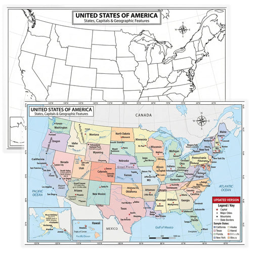
- The map. The World Map dry erase study map has a full-color labeled map on the front and a blank world outline on the back. For US geography, the United States dry erase map does the same with all fifty states.
- Markers. Dry-erase markers for games that get wiped the same day. Wet-erase markers for anything that should stay up for a week, like a current events map, since they do not smudge when brushed. Both work on these maps.
- Something to wipe with. A sock over the hand works as well as an eraser, and children like it more.
At 11 x 17 inches, a map fits on a desk without covering everything else, which matters when half the games are played in pairs.
Which map games work for kindergarten to second grade?
Games on the labeled side that build familiarity with shapes and names, without asking children to recall anything yet.
1. Color the continents
Give each continent a color and have children trace its outline on the blank side in that color, copying from the front. Seven colors, seven continents. National Geographic lists them from largest to smallest as Asia, Africa, North America, South America, Antarctica, Europe and Australia, and that order makes a good second round: color them biggest to smallest.
This is the game behind "color coded" maps. Once children have colored continents a few times, the shapes start to stick.
2. Ocean and continent hunt
Call out a name, children find it on the labeled side and put a dot on it. Start with continents, then the five oceans. The first child to find it calls out where it is: "next to Africa", "at the bottom". That language, next to, above, below, is the real lesson.
3. I spy on the map
The classic, played on the front. "I spy something blue and very big" (the Pacific). "I spy a country shaped like a boot" (Italy). Children take turns spying. It builds the habit of looking closely at a map, which younger children rarely do on their own.
Which games build real recall for grades three to five?
Games on the blank side, where children have to produce the answer rather than recognize it.
4. Label race
Two minutes on the clock. Children label as many countries, states or capitals as they can on the blank side, then flip to the front and check. Wipe, and do it again next week. The score should rise, and children can see it rising.
Keep the scope small. One continent at a time on a regional map beats the whole world at once. The World Geography Map Set 9-pack gives you the world, the US, Canada, Central America and Mexico, South America, Africa, Europe, Asia, and Australia and Oceania, each with its own blank back, so the race can move region by region.
5. Mystery country
One child picks a country and gives three clues, from general to specific: the continent, an ocean or neighbor it touches, and one fact. The others mark their guess on the blank side. Then everyone flips to check.
This is where a country map like the Brazil map poster earns its place: once a child has guessed Brazil, they can look at its states and cities in detail.
6. Neighbor chain
Start with one country. The next child names a country that shares a border with it, then the next names a neighbor of that one, and so on. Draw the chain on the blank map as an arrow from country to country. The chain ends when someone gets stuck, and the longest chain of the week wins.
Europe and Africa are the best continents for this, because so many countries touch. The Europe and Africa maps both have the blank back you need.
Which games teach map skills, not just names?
Games that use the lines, scale and shape of the map, not only the labels.
7. Latitude hunt
National Geographic defines latitude as the measurement of distance north or south of the Equator, with the Equator at 0 degrees and the poles at 90 degrees. Our world maps print latitude lines up the side, along with the Prime Meridian and the International Date Line.
Call out a line, "trace the Equator", "trace 30 degrees north", and children trace it in marker across the map, then name three countries it passes through. Older children can find a country from its latitude alone.
8. Route tracing
Children trace a journey on the blank map: a plane from home to a relative in another country, a ship from one ocean to another, the route of an explorer from a history lesson. They name every continent and ocean they cross. It turns the map into a story, and it is the best game for children who find labeling dull.
9. Projection detective
Put a globe next to the map and ask: which countries look bigger on the map than on the globe? Children circle them.
The US Geological Survey says plainly that every flat map misrepresents the surface of the Earth in some way, and that on Mercator maps, areas near the poles are grossly distorted. Children usually spot the countries in the far north first. The point is not that the map is wrong. It is that every flat map has to choose what to stretch. For more on why classroom maps look the way they do, see best world maps for classrooms.
How do you use a map for current events?
Keep one map up all week and mark the places that come up in class.
10. This week on the map
Hang a map on the wall and, whenever a place comes up, in the news, a story, a classmate's family, mark it with a wet-erase dot and a word. On Friday, look at the week's dots together, and wipe it for Monday.
The 2026 Updated World Map works well here, since a current events map should match current country names. For where a wall map like this fits in a full display, see geography map wall setup ideas.
How often should kids play map games?
Ten minutes, two or three times a week, beats an hour once a week.
That is distributed practice, the same strategy Dunlosky's review rates most effective. A short game on Tuesday and Thursday, with the same map, means children recall what they learned two days earlier, which is what makes it stick. A label race in September and another in October will show you exactly what has been remembered.
Mix the games. Use a recall game from the grades three to five list at least once a week, even with younger children who are ready, because that is where the remembering happens. The others keep it fun.
Which maps do you need?
Start with one world map per child or pair, and add regions as you go.
| Setup | What to buy | Why |
|---|---|---|
| One child at home | USA and World 2-piece set | Covers the two maps most games use |
| Small group or homeschool | World Geography 9-pack | Every continent region for label races and neighbor chains |
| Whole class or co-op | World Geography 24-pack | Adds country maps for mystery country and research |
Every map is double-sided with a blank back. The full range, including single country maps, is in the laminated map posters collection.